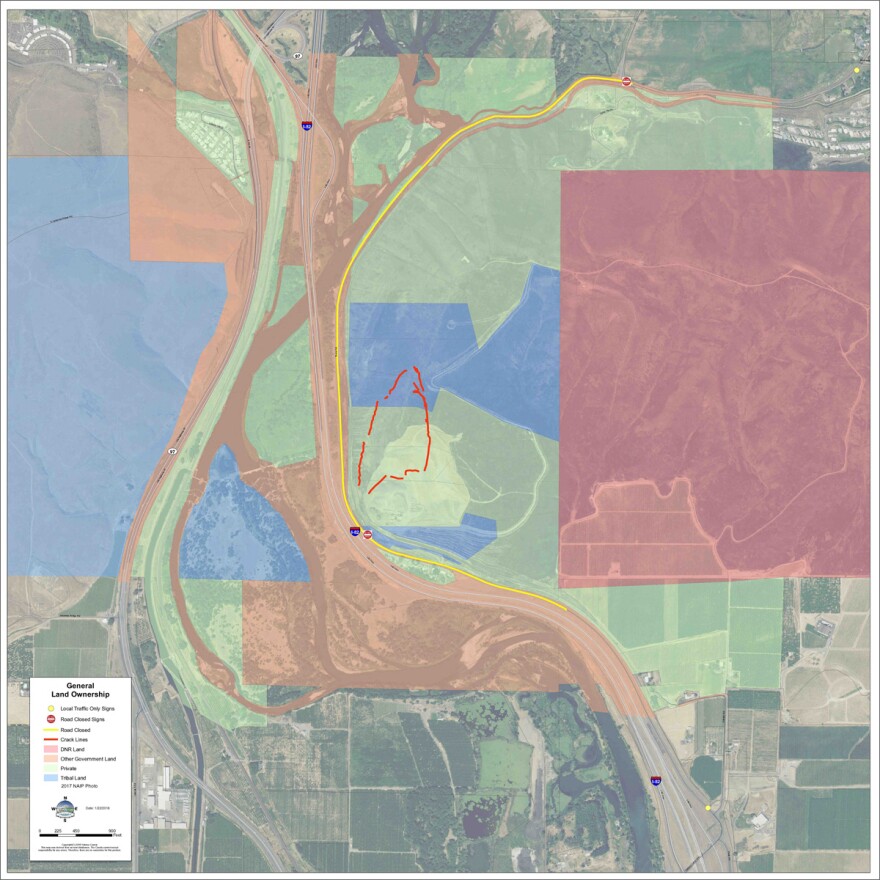
The Yakama Nation is asking Washington Gov. Jay Inslee to declare a state of emergency for the Rattlesnake Ridge landslide. It’s a steep slope outside of Yakima that is moving slowly and clings above a small community, a railroad corridor, Interstate 82 and the Yakima River.
The tribes have a lot to lose if it goes down.
Rattlesnake Ridge is an important geological feature of the Yakama Nation’s traditional lands. It faces another ridge across a narrow valley. If Rattlesnake Ridge really slides—in the worst case scenario—that could deeply affect the tribes.

First, there’s actual tribal property on the top of the ridge.
“That’s a concern because once that ridge slides what happens to that property?" said Elizabeth Sanchey, the incident commander in charge of the Rattlesnake Ridge landslide for the Yakama Nation. "Does the property remove, do the lines remain? What happens to that property? It’s a huge question right now.”
Then there’s the historical value of the ridge to the tribes. The tribes won an important battle there against the U.S. Army in the 1800s.
And there’s even an old legend about crickets, frogs and the Grizzly Bear. Sanchey said it involves animals arguing from the opposite ridges and it explains why we have one day and one night of rest per week.
“Frogs and crickets were saying, ‘One day, one night, one day, one night.’ And Grizzly Bear was trying to say longer—because you know he likes to hibernate and rest. But he couldn’t get his voice heard because cricket and frog were speaking so quickly, ‘One day, one night, one day, one night.’ And so now you see the result of that, we rest one day, one night.”
But the thing that concerns Sanchey the most is what will happen to the Yakama Nation’s irrigation water and massive agriculture operations if a huge slide hits the Yakima River. ?
The tribes’ major diversion dam for irrigation water lies right below the potential slide area. If that water were to be impacted during the spring or summer, it could pummel highly productive farms on the reservation.
“If agriculture doesn’t happen on this reservation for a summer—it’s a scary thought,” Sanchey said. “It’s what keeps the reservation and the people afloat.”
The tribes are also worried about listed salmon species, bull trout and their valuable fishing platforms perched just below the landslide area.
And then there’s the interstate and highways.
If the landslide comes down over Interstate 82, then Highway 97 would be the backup. That runs right through the Yakama Nation reservation for nearly 15 miles.

“So highway 97 has a lot of intersections that have just stop signs onto the main highway,” Sanchey said. “And so there is a lot of accidents in the area. We also have a lot of people who walk Highway 97, so there’s a concern about increased risk of fatality because of the walkers and the high traffic volume. And who knows how long that alternate route will be in place.”
Sanchey said she’s worried about the landslide not just as a tribal official, but personally. She’s telling those she loves not to drive on I-82. She said despite all the monitoring and the best predictions, in the end, people are at the mercy of the slide.
For weeks now, Sanchey has been working long hours.
“I took my daughter on the road the other day. I felt like at that moment it was safe and if we went fast it’d be fine,” she said. “But I wanted her to get a scope of what’s going on so she understands why I’m working 10 and 12 hour days and why I’m not home.”


